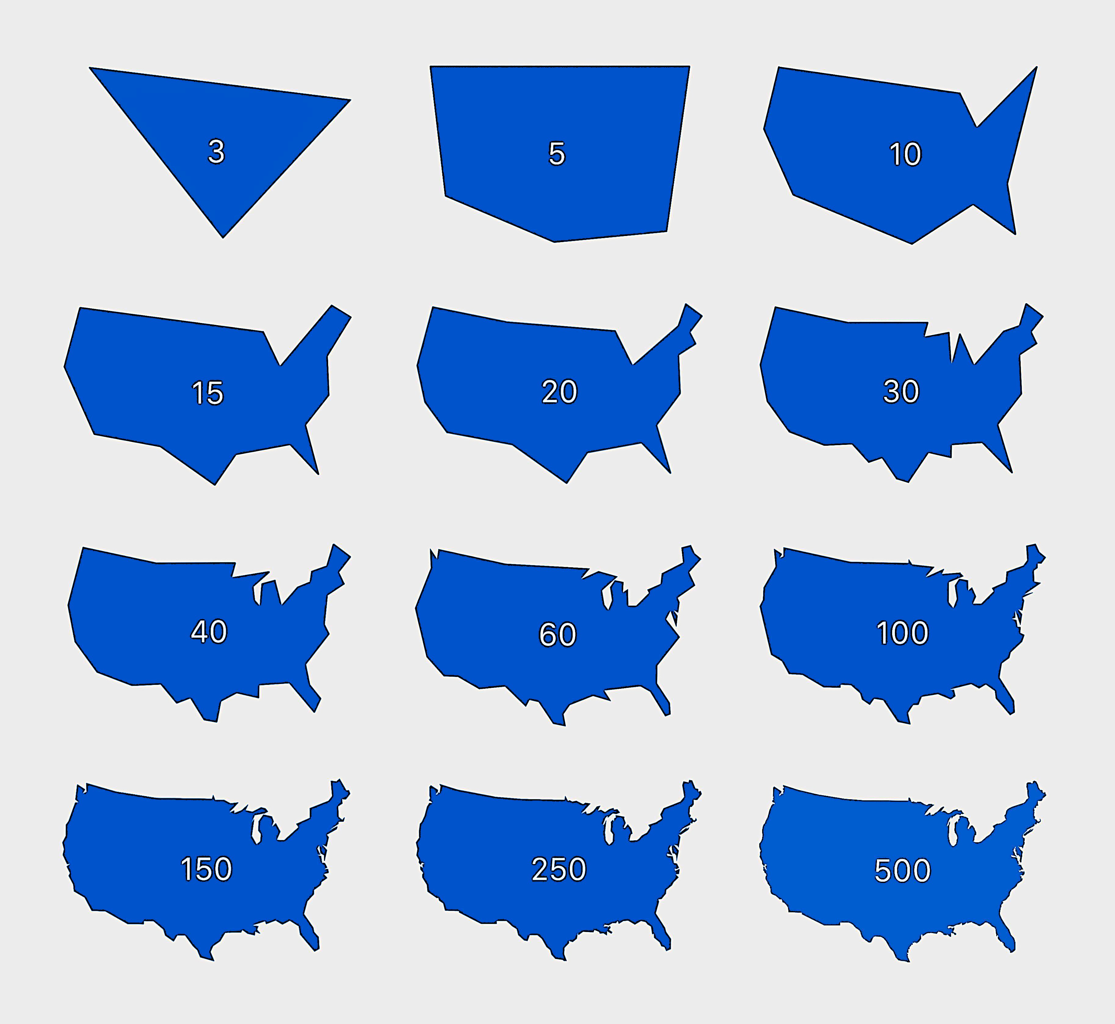
The Picard Maneuver@lemmy.worldM to Cartography Anarchy@lemm.eeEnglish · 18 days agoDrawing the USA with an increasing number of edgeslemmy.worldimagemessage-square24fedilinkarrow-up1337
arrow-up1337imageDrawing the USA with an increasing number of edgeslemmy.worldThe Picard Maneuver@lemmy.worldM to Cartography Anarchy@lemm.eeEnglish · 18 days agomessage-square24fedilink
minus-squaretakeheart@lemmy.worldlinkfedilinkEnglisharrow-up13·18 days agoWhat’s a systematic algorithm for finding the best approximation (minimal under/overshoot of area) when you are given a raster or vector image representing the “real” borders? Or it just trial and error?
minus-squareJake Farm@sopuli.xyzlinkfedilinkEnglisharrow-up2·18 days agoI’d imagine it would be a case by case basis.

What’s a systematic algorithm for finding the best approximation (minimal under/overshoot of area) when you are given a raster or vector image representing the “real” borders? Or it just trial and error?
I’d imagine it would be a case by case basis.